Connecting with nature is a valued activity for the staff at Skagit Land Trust. One of best parts of the job is getting to explore special places that are conserved for wildlife and people. This handout includes staff picks for conservation areas you can visit in Northwest Washington that have been protected with the help of a local land trust. Some are here in Skagit County, and you helped protect them! Others are a short drive or boat ride away. All of them highlight the important work land trusts do to ensure there will be places that protect and connect people with nature for generations to come.
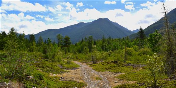
Land Trust: Owned and managed by Skagit Land Trust; transferred to SLT from The Nature Conservancy
Staff Pick: Jonathan Worley, SLT Stewardship Coordinator
Details: 1/2 mile round trip, flat
About the Hike: This quiet 100-acre conservation area is located along a picturesque stretch of the federally designated Wild and Scenic Cascade River. It features stands of maturing riparian forest and an unusual rocky meadow that hosts groundcover plant species like kinnikinnick, wild strawberry, and a variety of mosses and lichens. The property is great to visit in all seasons - relax in the shade by the river in the summertime and look for bald eagles dotting trees along the shoreline in the wintertime. It’s also an excellent example of what can be achieved through strong partnerships, like that between Skagit Land Trust and The Nature Conservancy!
Getting There: Google Maps. From Mount Vernon, drive east on Highway 20. Once you reach Marblemount, continue straight across the bridge onto Cascade River Road. Turn right on Rockport Cascade Road, then take the first left onto South Cascade Road. Drive 1.3 miles. NOTE: the paved road becomes a gravel road with occasional small potholes - vehicles with very low clearance may not be suitable. The Cascade River Conservation Area will be on the left, indicated by Skagit Land Trust signage. Park in the pullout and continue on foot beyond the gate and into the Conservation Area.
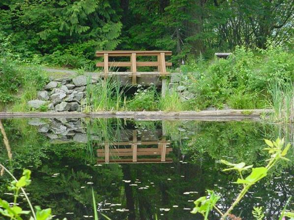
Squires Lake, Skagit/Whatcom County Border
Land Trust: Whatcom Land Trust Assisted Project with Whatcom County Parks
Staff Pick: Laura Hartner, SLT Development Director
Details: 1/3 mile uphill trail to the lake, 1 mile flat around the lake
About the Hike: In 1995, Whatcom Land Trust assisted Whatcom County Parks in acquiring this 82-acre park, now cooperatively managed by the Whatcom and Skagit County Parks & Recreation Departments. It is a great property to visit with children of all ages. The 1/3 of a mile uphill trail rewards you at the top with a serene lake, bridge over a little waterfall, and benches. A 1.1 mile multi-use loop trail leads around the lake. There are lots of spots to stop and take in the views and wildlife. Side loop trails lead to a beaver pond. I discovered the trail in the spring of 2020 while looking for hikes to get my three-year-old’s energy out. Now seven, this hike is still one of my son's favorites. He especially likes the boot brush station at the start of the trail.
Getting There: Google Map From Skagit County, head north on I-5. Take exit 242 for Nulle Road/Old Hwy 99. Turn right off the exit and follow the road for about half a mile. The parking area will be on your left.
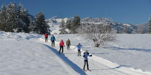
Land Trust: Trust for Public Land Conservation Easement with Trail Access
Staff Pick: Max Morange, SLT Stewardship Director
Details: Easy to navigate in winter. TPL is not clear on summer access.
About the Hike: Cross country skiing through this amazing area near the head of the Methow River affords wide open vistas and serenity along with the chance to see valley wildlife, healthy forests, and the results of innovative conservation in action. The Trust for Public Land (TPL) conserved this property between 2000 and 2004 after multiple plans failed to develop hundreds of houses there. Instead, TPL worked with WA Department of Fish and Wildlife to steward conservation easements on the property while selling five individual private parcels to conservation-minded individuals. The easement on each parcel restricts development on each property to one, three-acre home site, with the remainder preserved for wildlife and low impact public recreation.
Getting There: Google Maps. From Skagit County, head east on HWY 20 across the North Cascades. Multiple trailheads for the Methow Valley trails system allow limited winter access to the 1,200-acre Early Winters Property, commonly known as the Arrowleaf. One easy trailhead with parking is called Jack’s Loop Trail, immediately off HWY 20 West of Mazama.
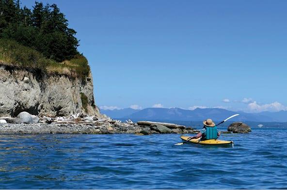
Land Trust: Whidbey Camano Land Trust Assisted Project with Island County
Staff Pick: Jessica Lange, SLT Conservation Project Manager
Details: 2.4 miles of moderately flat, well-maintained and signed forest trails. Descend the bluff trail for year-round beach access. Tide permitting, hike the 1 mile of beach shoreline.
About the Hike: In 2016 Whidbey Camano Land Trust (WCLT) worked with the Barnum Family to purchase land at the mouth of Triangle Cove that had been in the family for more than 100 years. The acquisition allowed WCLT to expand the County park from a 27-acre sliver of upland forest to a 167-acre nature park for the whole community. It is a perfect spot for people of all ages and abilities. There are several trails throughout the park perfect for a choose-your-own adventure visit. The property features a mature coastal forest, an open meadow, and about a mile of unspoiled beach and bluffs with views of Port Susan and the Cascade Mountains. It is a great place to observe migrating and resident birds.
Getting There: Google Maps. From Skagit County, head south on I-5. Take exit 212 towards WA-532 W. Keep right at the fork to merge onto WA-532 W towards Stanwood and Camano Island. At Terry’s Corner, turn left onto N Sunrise Blvd. In 2.8 miles turn right into the park. For a more scenic drive take Pioneer Highway and Old Pacific Highway south from Skagit County. Note: You have to put “Barnum Point Preserve Trailhead” in Google Maps, otherwise it takes you to a non-accessible point on adjacent property.
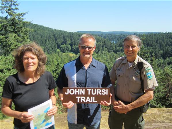
Land Trust: Skagit Land Trust facilitated partnership with Skagit County Parks and Deception Pass State Park
Staff Pick: Molly Doran, SLT Executive Director
Details: 1.1 mile (one way) maintained, moderate trail with some ups and downs.
About the Hike: The trail is between the Anacortes Community Forest Lands and Deception Pass State Park. It traverses past meadows and rocky balds, a red rock quarry, a miner’s shack, the “rock” of artist Morris Graves’ lore, and views of Pass Lake, Campbell Lake, and Mount Erie. It starts (or ends) in the old growth forest at Pass Lake in Deception Pass State Park. SLT did the real estate and landowner outreach to get this trail in place that is now partially owned by the County and partially owned by the State Park. SLT holds conservation easements on the ACFL near the northern edge of the trail and has also helped to add another 80 acres just off the trail to Deception Pass State Park. The trail is 1.1-mile one way. It is accessible year-round and very lovely always. I especially like it in spring with wildflowers out. John Tursi was a dear friend of many of us and a great conservationist.
Getting There: Pass Lake Trailhead: From Highway 20, turn on Rosario Road and make first right into Pass Lake parking lot. Hike NE on Pass Lake Trail and at 0.7 mi head up Ginnett Hill Trail. After 0.9 mi reach the Old Ginnett Homestead. Stay right at junction to head north onto the Tursi Trail. Donnel Road Trailhead: From the Campbell Lake Road parking area east of Heart Lake Road, traverse on Donnell Road south 0.5 mi to trail entrance. Please stay on trail or road as some of it crosses private property.
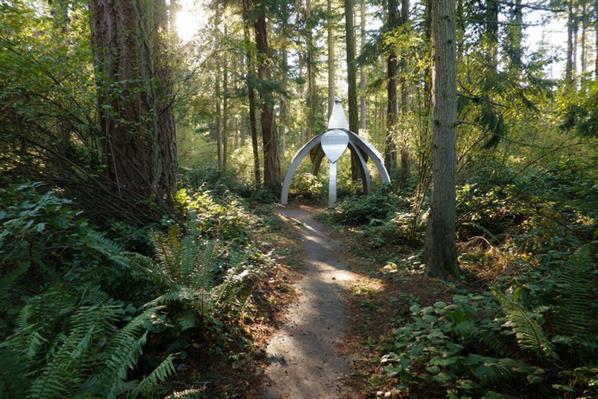
Land Trust: Whidbey Camano Land Trust Conservation Easement
Staff Pick: Jaz Strode-Elfant, SLT Membership and Office Administrator
Details: 16-acre property with a flat, maintained trail through forest and sculptures. Stroller friendly. No pets.
About the Hike: A short gentle trail through a sculpture garden set in a beautiful forest protected by a conservation easement with Whidbey Camano Land Trust. This site is great for all ages, has an interactive app for self-guided tours, and is an excellent intersection of art and nature (including art in situ, built to be in the forest!).
Getting There: Google Maps. From Highway 20 in the center of Coupeville: At the only traffic light, turn north onto N Main Street towards the downtown historic waterfront area. Go 0.5 mile and turn right on NE 9th Street. Go 1.5 miles (the road name automatically changes from 9th Street to Parker Road) until property is on left, just past Burnham Place on left/north and well before Crown Avenue.
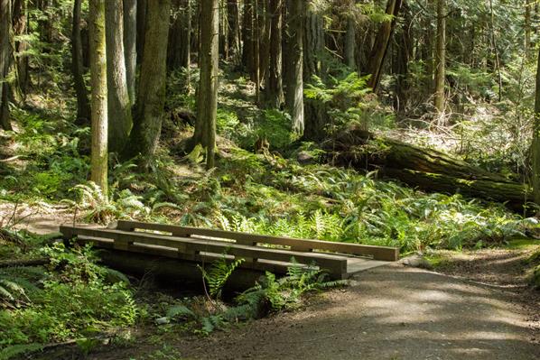
Land Trust: Whatcom Land Trust, managed in partnership with Whatcom County Parks and WA DNR
Staff Pick: Stacy Dahl, SLT Volunteer & Education Programs Coordinator
Details: 4.9 miles of easy/moderate trails with some moderate elevation gain. No dogs allowed.
About the Hike: This is nature close to home for me because the park has an entrance through my neighborhood. Although I love taking my dog on hikes, this Reserve is dog-free so offers a different kind of experience. The Reserve offers over 4 miles of hiking trails through a beautiful forest setting. The trees are mature with old growth characteristics. Douglas fir trees can be found along the trail that are over 400 years old. The trail is shaded and cool during summer months. Two ponds on the property support a variety of plants and wildlife. Wanting to visit without your car? You can take public transit from downtown Bellingham via Whatcom Transit bus 512. The bus stops at the entrance to the Reserve.
Getting There: Google Maps From Skagit County, take I-5 north to Lake Samish Road (exit 240). Turn right. Take Alger/Cain Lake Road (5.3 miles) to Lake Whatcom Blvd. (Make a left at the fork in the road.) Drive 3.2 miles to Lake Louise Road, turn left. Reserve is 2.9 miles further on the right.
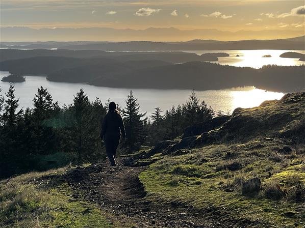
Land Trust: Owned by San Juan County Land Bank; protected by a conservation easement held by San Juan Preservation Trust
Staff Pick: Michael Kirshenbaum, SLT Conservation Director
Details: Several well-maintained trails with 860 ft of elevation gain to summit areas.
About the Hike: This 1,718-acre preserve is an iconic landmark on Orcas Island and one of the largest protected natural areas in San Juan County. The preserve features 8.7 miles of hiking trails through mature forest and open meadows. Numerous hilltop overlooks offer 360-degree views of the islands. The preserve was protected by the San Juan County Conservation Land Bank (SJCCLB) in 2006 with support from San Juan Preservation Trust (SJPT), The Trust for Public Land, and more than 2,000 individuals and families. Recently SJCCLB and SJPT expanded protection at the site and connected public access from Turtlehead to Turtleback via what is known to the community as "Turtleneck."
Getting There: Google Maps Take ferry to Orcas Island. Follow Orcas Rd. Turn left on Deer Harbor Rd. Turn right onto Wild Rose Ln.
Land Trust: Skagit Land Trust owned and managed
Staff Pick: Sydney Benson, SLT AmeriCorps 2024
Details: Two miles of flat trails with several options; may have some obstacles on trails to Skagit River at certain times of year
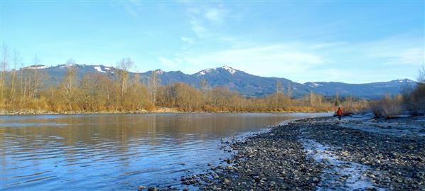
About the Hike: This 211-acre property situated in the floodplain of the Skagit River provides a network of trails great for people of all ages. Head out during a salmon run and you may get the chance to see salmon spawning in the over 4,000 feet of salmon habitat this property provides. As you venture in, keep your voice down and you may see elk or wood ducks by the oxbow pond. Be sure to check out the short LEAF trail before you leave to see the mysterious row of cedars that make a perfect 90-degree angle!
Getting There: Google Maps From the South Skagit Hwy Park & Ride in Sedro-Woolley off of Route 9, take the S. Skagit Hwy 12 miles east. Look for the parking area in front of the locked gate on the left side of the road. The bridge and Skagit Land Trust signs are just beyond the gate. Park in front of the gate and walk in.
 .
.
Land Trust: Barr Creek – owned and managed by Skagit Land Trust, Sauk Mountain – owned and managed by Mount Baker Snoqualmie National Forest
Staff Pick: Kari Odden, SLT Conservation Project Manager
Details: The well-maintained Hegg-Benson Loop Trail and Dancing Bear Spur on Barr Creek have slight elevation gain. The popular 4-mile Sauk Mountain Trail has 1,200 feet of consistent uphill to reach summit.
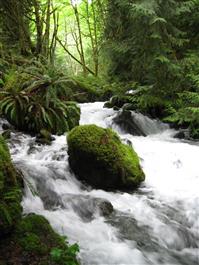
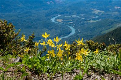
About the Hike: Visit two beautiful areas in one trip. SLT’s Barr Creek Conservation Area features a 1.2 mile round trip Hegg-Benson/Dancing Bear trail through a lush forest to a waterfall viewing area. This 50 acre property was protected by the Trust and its members in 2008 and expanded in 2017. On your way back from Barr Creek, take a 30 minute drive up to the Sauk Mountain trailhead in the Mount Baker-Snoqualmie National Forest. This 4 mile round trip hike will reward you with beautiful views of undeveloped Skagit floodplain and many land trust protected properties!
Getting There: To Barr Creek: Take Highway 20 east to Rockport. Turn left onto Conrad Road at milepost 98, approximately 1.5 miles after the junction of Highway 20 and Highway 530 (which leads to Darrington). Take a left on Conrad Road and drive up the hill, passing several private homes. Approximately 100 yards after house #54607 look for a pullout and the trailhead on the left side of Conrad Road.
To Sauk Mountain: Take Highway 20 East from Sedro Woolley for approximately 30 miles, then turn left at Sauk Mountain Road (FS 1030). Stay on this road, ignoring any little side roads, for 7.9 miles to the road’s end and trailhead.