The Cascade River South II Conservation Area protects a beautiful natural area along the Cascade River, a major tributary to the upper Skagit River that drains from the North Cascades mountains.
Skagit Land Trust assisted The Nature Conservancy in acquiring this land along the Cascade River with funds from the WA State Salmon Recovery Funding Board. The Cascade River South II Conservation Area is one of nine properties transferred from The Nature Conservancy (TNC) to Skagit Land Trust in 2017. This aquisition of 1,024 acres, expands the total area of lands managed by the Skagit Land Trust by over one third.
Click here to read more about the land acquisition between The Nature Conservancy and the Skagit Land Trust in our Summer 2017 Newsletter.
In partnership with The Nature Conservancy, the Skagit Land Trust has worked for over six years prior to co-steward properties located in the upper Skagit River watershed. Many of the tributary streams serve as important salmon habitat.
Conservation History
Bald eagle habitat protection was a motivating factor for The Nature Conservancy and other community partners to conserve many properties in this area over 30 years ago. The Cascade River South II Conservation Area is part of over 8,000 acres of habitat that comprise the Skagit River Bald Eagle Natural Area.
“It was the endangered bald eagle that brought The Nature Conservancy to the Skagit in the 1970’s. And it was the salmon - that eagles and so many other species depend on – that sustained our attention through the years. As we look to the future it’s the people. People need to steward this landscape; and they will benefit for generations from its natural beauty and abundance.” said TNC Strategic Partnerships Director Bob Carey. “Skagit Land Trust is the perfect organization to make sure these connections between people and nature endure.”
The Skagit Eagle Festival is a month-long celebration during the eagle-watching season in eastern Skagit County, founded and supported by the communities of the upper Skagit. Activities take place in Concrete, Rockport, and Marblemount every full weekend in January. Running for over 30 years, the Skagit Eagle Festival attracts thousands of visitors to these communities to view hundreds of bald eagles.
Ecology
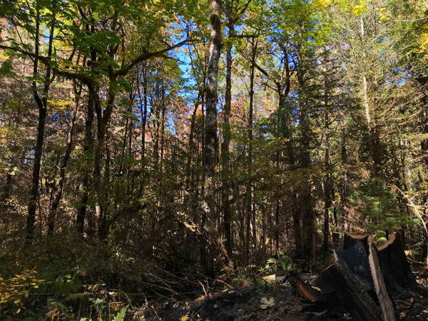
The Cascade River South II Conservation Area provides excellent habitat along the Cascade River with over 2,800 feet of river shoreline and buffering riparian(shoreline) habitat. The majority of the property is a maturing riparian forest with a mix of coniferous and deciduous species. Stumps on the property indicate it was logged at least once since the 1900s.
Cascade River is a tributary to the Skagit River which drains from the North Cascades National Park and Mount-Baker Snoqualmie National Forest. Cascade Pass, one of the most popular trails in North Cascades National Park, is just 10 miles upstream. The mosaic of tributary streams, wetlands, and shorelines serve as habitat for a variety of fish and wildlife. The property provides important spawning grounds for endangered species of fish (including Bull Trout and Chinook Salmon) as well as habitat for other birds and mammals including bald eagles, raptors, river otter, black bear, coyote and marten. Long-term management goals for Cascade River South II Conservation Area are supported by the Salmon Recovery Funding Board program.
.JPG)
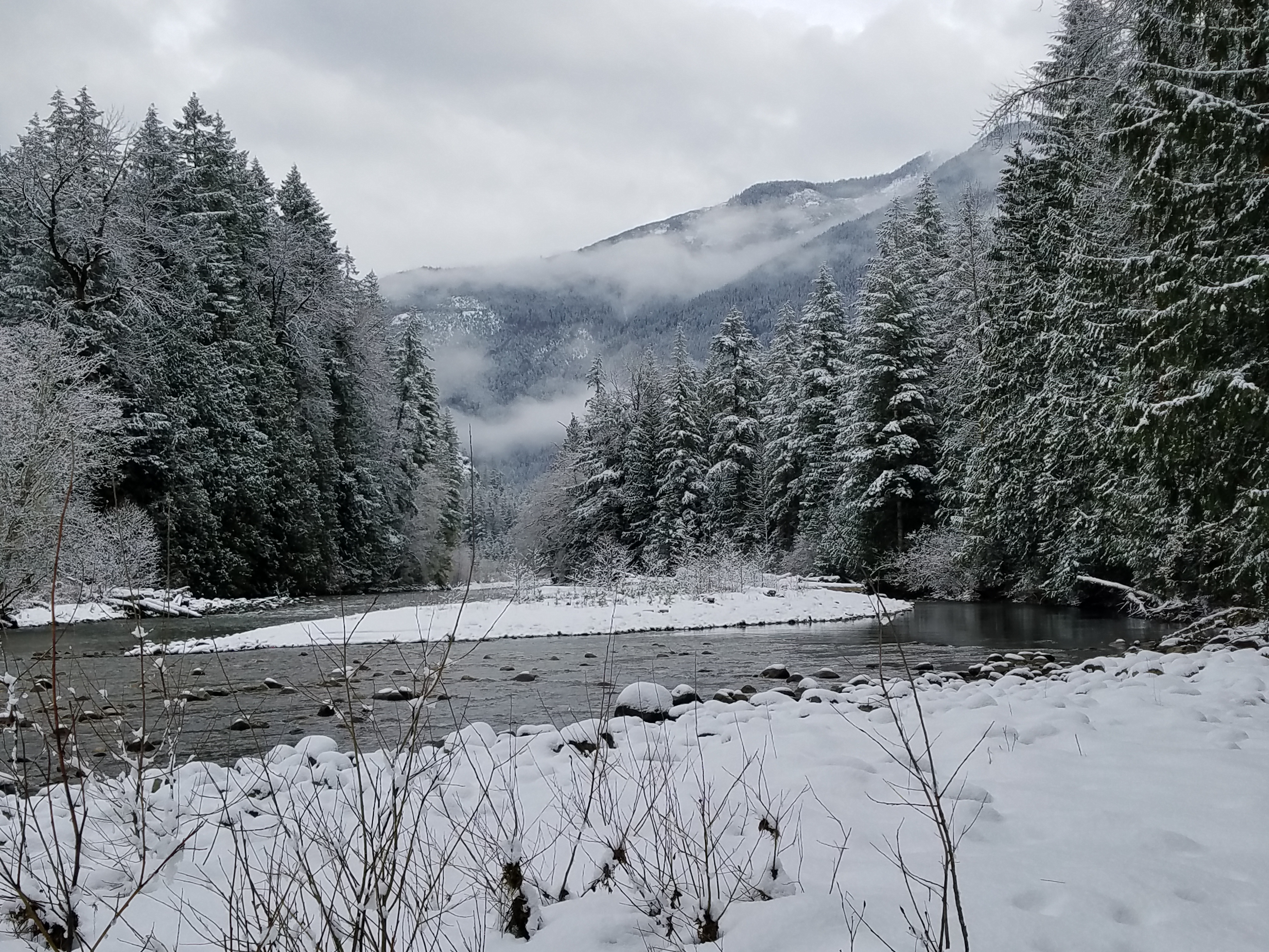
Above: The Cascade River was designated as a Wild and Scenic River by the U.S. Congress in 1978. It is a tributary of the Skagit River, the only large river system in Washington State which currently supports all five species of native salmon and two species of native trout. The lichen visible in the picture are sensitive to air pollution and a good indicator of air quality. Photograph credit: Skagit Land Trust staff.
Within the Cascade River South II Conservation Area live sensitive types of lichen that can only grow in places with high air quality. The shallow soil and open nature of the site supports a large variety of plants such as wildflowers and berries, which in turn provide food for wildlife in the area. This property is adjacent to three other Conservation Areas managed by Skagit Land Trust, ensuring the protection of a large portion of Cascade River shoreline.
Historically, the Upper Skagit and Sauk-Suiattle Tribes stewarded land in the vicinity of the Cascade River.
.JPG)
Stewardship of this property and others is only possible through the hard work of our many volunteers. Above: volunteers survey the Cascade River South II Conservation Area in 2014.
Click here to view information about the land stewards for this and other Skagit Land Trust properties.
Access
The Cascade River South II Conservation Area is open to low-impact use public access. The property entrance is on South Cascade Road, 1.3 miles after the turnoff with Cascade Rockport Road. The entrance is blocked by a gate. Beyond the gate the property is easily walkable. A short path leads from the property entrance to the banks of the Cascade River.
Click here for for a link to Google maps for the parking area along South Cascade Road.
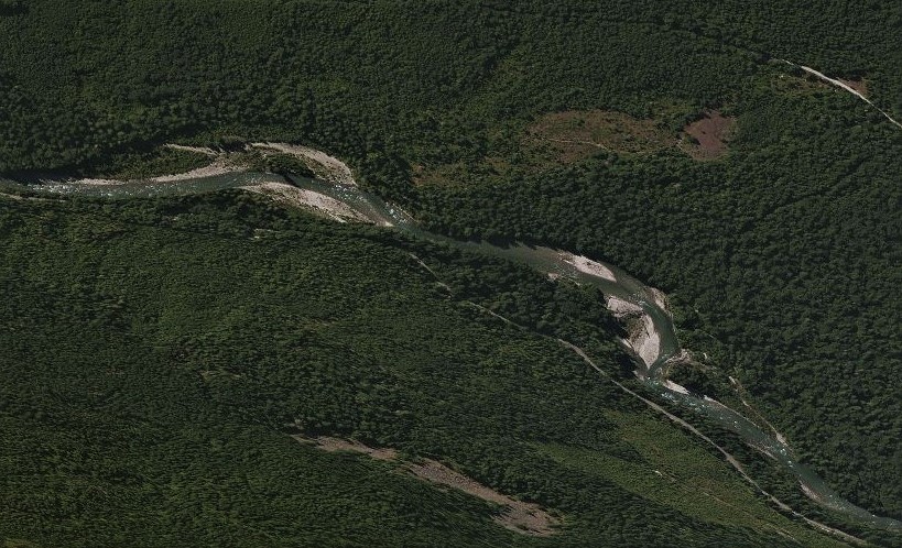
Aerial photograph of the Cascade River South II Conservation Area.
Neighboring properties are managed by WA State and Skagit County. Note that nearby upslope lands owned by Sierra Pacific and Washington Department of Natural Resources are in active timber production.
Hunting and fishing is allowed in accordance to Skagit Land Trust's public access policy.
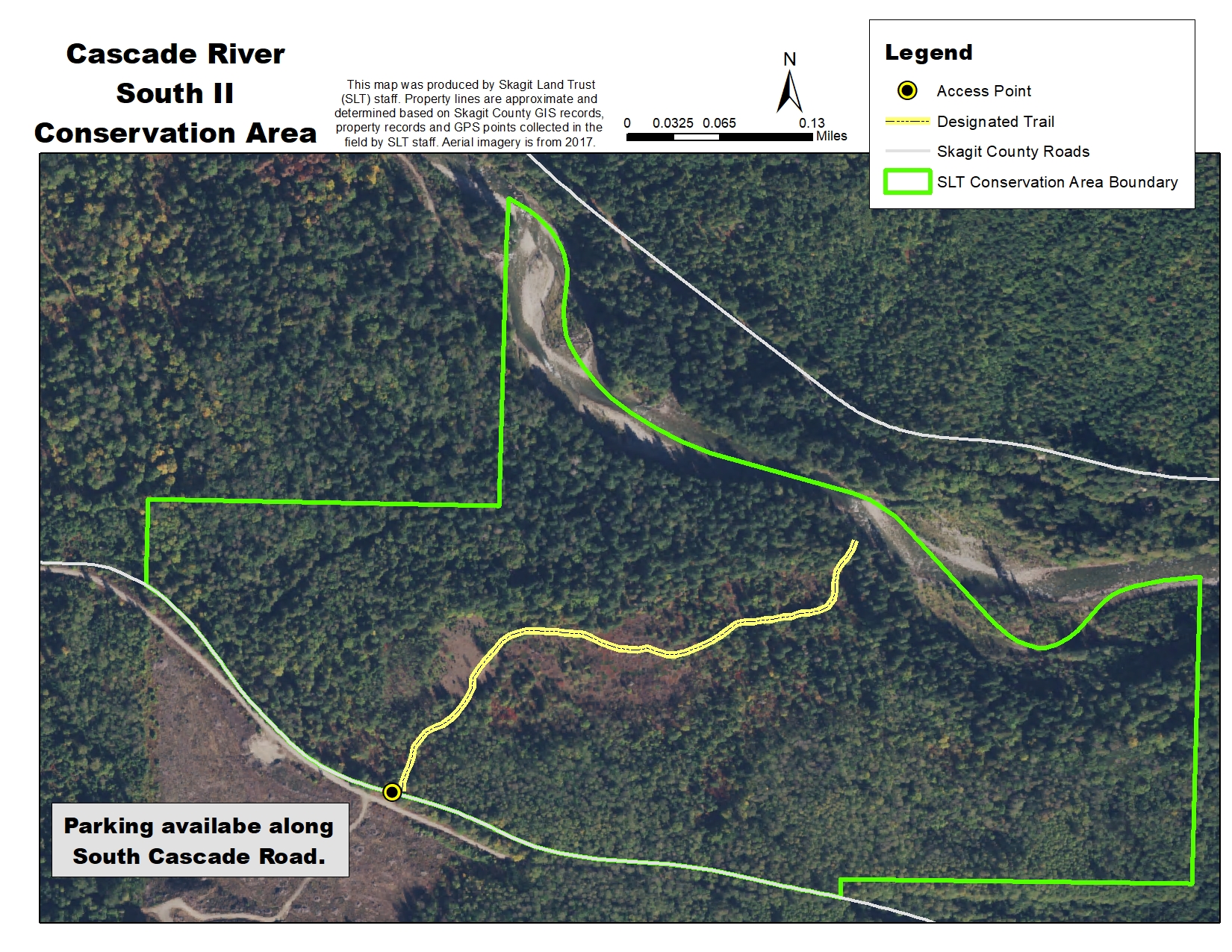
Click on the map above for a larger image. Map generated using 2017 NAIP aerial imagergy.
Drive east on Highway 20. In Marblemount, continue straight across the bridge onto Cascade River Road. Turn right on Rockport Cascade Road, then take the first left onto South Cascade Road. Drive 1.3 miles. The South Cascade River Conservation Area will be on the left, to the north. There is a parking area with a road continuing into the property, blocked by a gate.