Trillium Conservation Area is one of nine properties transferred from The Nature Conservancy (TNC) to Skagit Land Trust in March of 2017. This aquisition of 1,024 acres expands the total area of lands managed by Skagit Land Trust by over one third at the time of the transfer.
Trillium Conservation Area was set aside for conservation over 30 years prior by The Nature Conservancy and other community partners who desired to conserve habitat for Bald Eagle and other species along the upper Skagit River. Trillium Conservation Area was part of the conservation of over 8,000 acres that now make up the Skagit River Bald Eagle Natural Area.
Click here to read more about the land acquisition between TNC and Skagit Land Trust in our Summer 2017 Newsletter.
Trillium Conservation Area is located along Hwy 20 about 4 miles northeast of the Cascade River Road and Hwy 20 intersection. The property in on the northwest side of Hwy 20. The immediate surrounding area is protected forest with the southeast corner touching Hwy 20. Many other properties along the upper Skagit are protected by SLT, TNC or other conservation organizations, creating a patchwork of protected and unprotected riparian lands. The majority of nearby upslope lands are actively in timber production or are part of the Mt. Baker-Snoqualmie National Forest, and North Cascades National Park is about one mile to the east. The Cascade River is part of the federally-designated Wild and Scenic river system.
Ecology
The Trillium Conservation Area is located on a steep hillside along the upper Skagit River, about a quarter mile southwest of Bacon Creek, and about a mile east of North Cascades National Park. The majority of the property supports old growth coniferous forest. Trillium is an inholding within USFS boundaries, and is surrounded by national forest on 3 sides. Portions of the property are steep scree slopes covered in moss and lichen, an uncommon ecosystem at low elevations. Trillium has been identified as a potential spotted owl “activity center” and supports the local bald eagle population. Trillium also contains salmonid habitat, with 280 feet of Skagit River frontage. Trillium is also part of the scenic view shed of Highway 20.
Access
The Trillium Conservation Area lies about 2 miles northeast of the town of Marblemount along Hwy 20. The property is open to low-impact public access.
Click here for a link to Google Maps for Trillium Conservation Area.
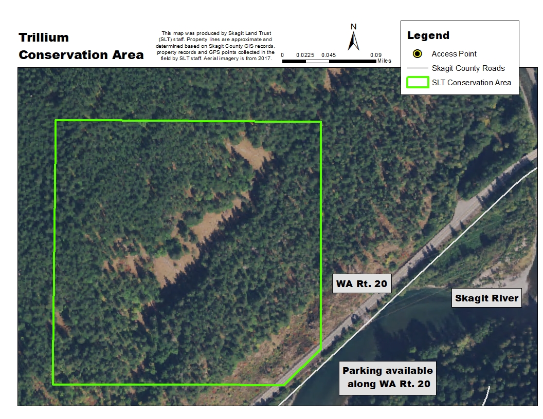
Click on the map above for an enlarged image. Map created using NAIP 2017 Aerial imagery.
Drive northeast on Hwy 20 to the town of Marblemount. Keep left on Hwy 20 from the Cascade River Rd intersection and drive 4.2 miles to a pull out on the left side of the road. From the pullout walk northwest up the hillside, staying just to the left of the very steep section. The property intersects Hwy 20 slightly farther east, but it is not accessible by hiking in at that point. Trillium Conservation Area is very steep and extremely difficult to access.