The Muddy Creek Conservation Area is located on the north side of the federally-designated Wild and Scenic Skagit River, just west of the town of Hamilton,a nd south of the Cascade Trail. Protection of the Muddy Creek Conservation Area is particularly important in stabilizing the shoreline of the Skagit River, which is prone to large seasonal floods.
Click here to read more about flooding along the Skagit River in the Lyman - Hamilton area near Muddy Creek Conservation Area in a Skagit Land Trust newsletter from 2016.
.JPG)
Above: Hardwood forest of Muddy Creek Conservation Area supports ecosystems along the Skagit River. Photograph credit: Skagit Land Trust staff.
Properties managed by the Skagit Land Trust along the Skagit River and nearby sloughs are crucial to the conservation and restoration of natural space. The land anchors valuable habitat for juvenile salmon traveling the Skagit. The slower moving waters of Carey Slough allow salmon to grow safely until they are strong enough to join the forceful currents of the Skagit River. These waters also provide resting grounds for salmon making their way upstream to spawn.
Muddy Creek Conservation Area is one of many Skagit Land Trust properties along the upper Skagit River watershed set aside for conservation. The Cumberland Creek Conservation Area lies directly across the Skagit River. The Day Creek Conservation Area, Day Creek Forest Conservation Area, Day Creek Kosbab Conservation Area and Lyman Slough Conservation Area are all located within three miles to the south and the west.
Ecology
The Muddy Creek Conservation Area contains a floodplain forest with lots of hardwoods and shrubs that absord flood waters and support season wetlands.
The protected forest of Muddy Creek Conservation Area improves water quality by filtering storm water runoff, shading and cooling the creeks and sloughs feeding into the Skagit, and providing a source of large woody debris to the Skagit River and tributaries which in turn provides habitat for a variety of species.
The property drains south into the Skagit River, where water levels are heavily influenced by large dams upstream. The Skagit River and shoreline is habitat for several salmonids, including Cutthroat, Sockeye, Steelhead, Pink, Chinook, Chum, and Rainbow Trout, as well as Bull Trout, all of which are priority species in Washington State.
Conservation partners (including the Skagit Watershed Council and Skagit Fisheries Enhancement Group) are helping the Trust restore this property and adjacent conservation properties owned by the Town of Hamilton, which the Trust helped protect.
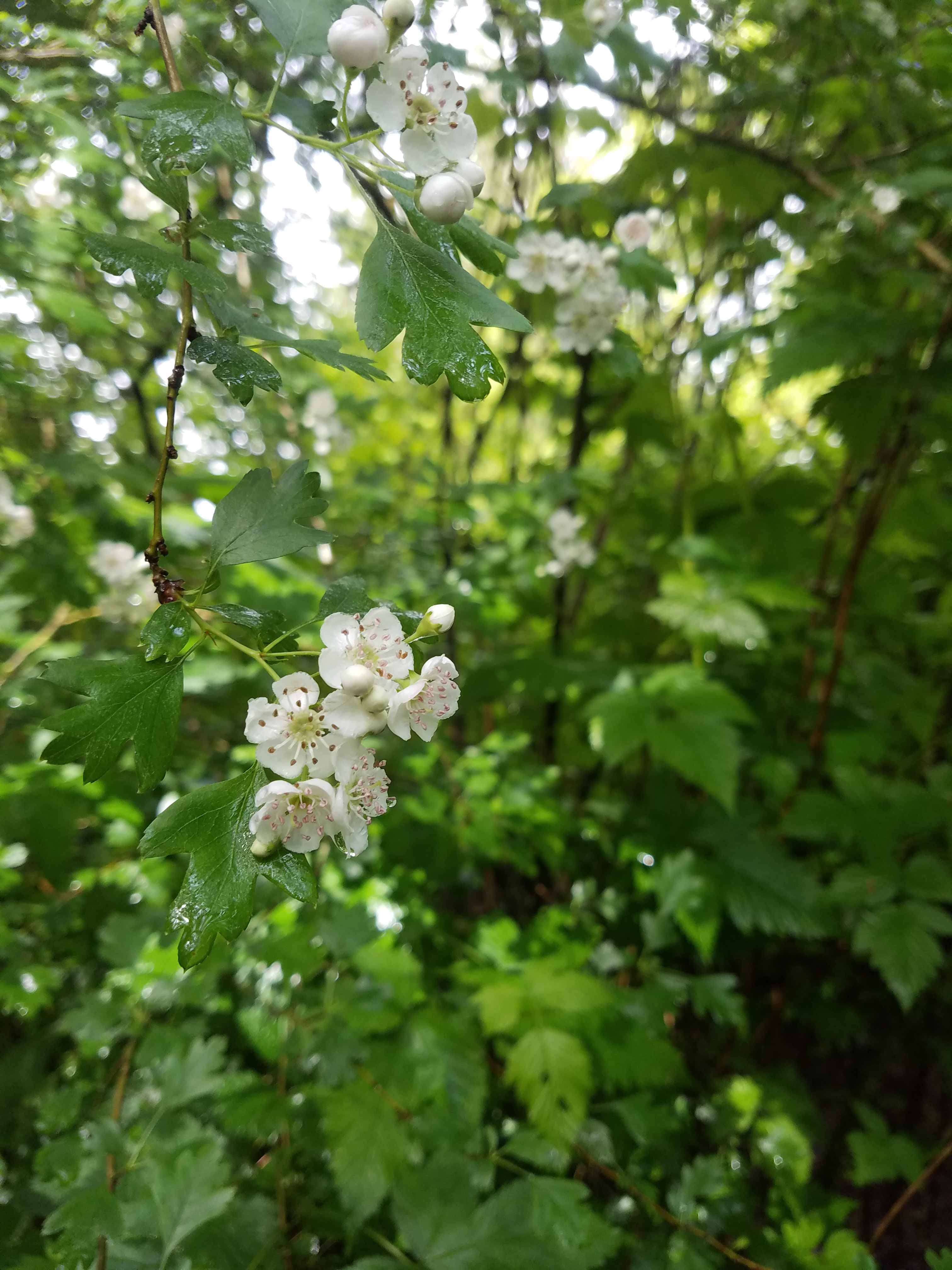
Above: Springtime flowers at Muddy Creek Conservation Area. Photograph credit: Skagit Land Trust staff.
The Skagit River is the only large river system in Washington State that supports healthy populations of all five native salmon species and two native species of trout. Muddy Creek Conservation Area is located in the Middle Skagit, an area where the river has historically migrated back and forth across the glacial valley. Along with other conservation organizations in the area, the middle Skagit properties managed by Skagit Land Trust create a patchwork of protected shoreline along the river.
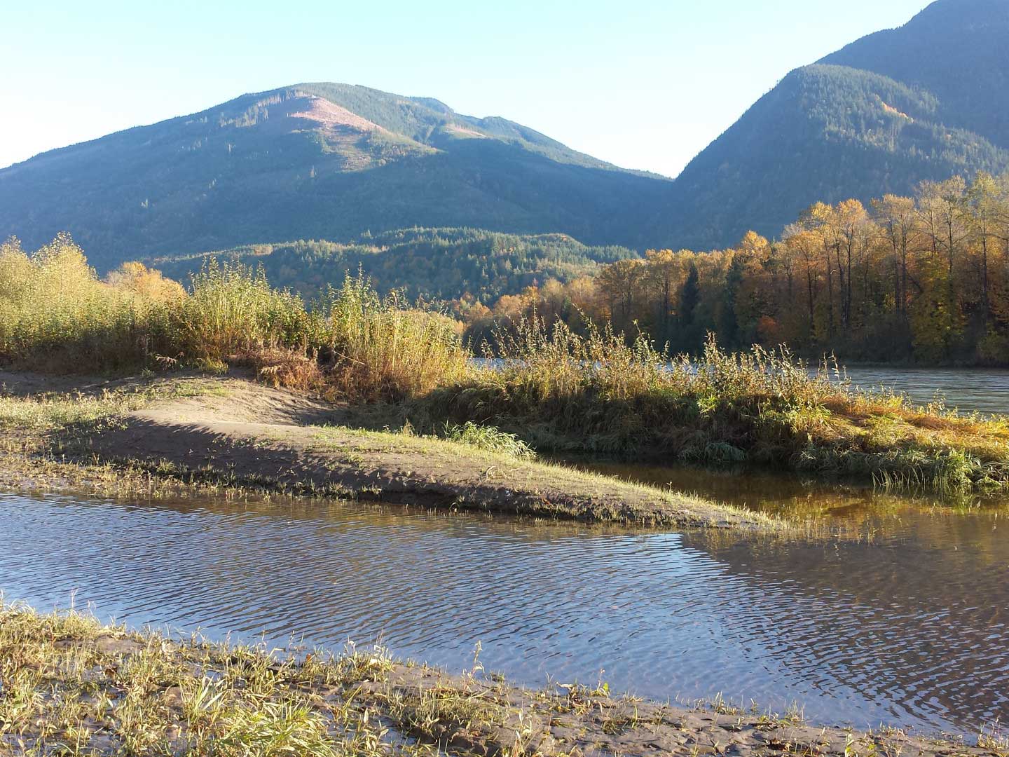
Above: The Muddy Creek Conservation Area protects riparian habitat along the Skagit River, which was designated as a Wild and Scenic River in 1978. The Skagit River is more than 160 miles long and is the third largest watershed on the west coast of the United States, providing 20% of the freshwater flowing into Puget Sound. Photograph credit: Skagit Land Trust staff.
Stewardship
Skagit Land Trust has partnered with Skagit Watershed Council, Skagit Fisheries Enhancement Group, Washington State Salmon Recovery Funding Board (SRFB), and the Town of Hamilton to improve shoreline habitat along the Skagit River.
In 2015, Skagit Land Trust began working with the Town of Hamilton and Skagit Fisheries Enhancement Group to develop a restoration plan to improve habitat at Carey’s Slough and Muddy Creek Conservation Area. Carey’s Slough is an oxbow lake that is located in the center of the town of Hamilton. The slough receives inflow from Carey’s Creek, and is connected to the Skagit River. This project included developing plans for replacing culverts at Petit Road and Lyman Hamilton Highway that were at the time impassable for fish. To read more about stewardship initiatives of the Skagit Fisheries Enhancement Group in Hamilton, click here.
Click here for information about the Land Stewards for this and other Skagit Land Trust properties.
.JPG)
Above and below: Members of the Skagit Fisheries Enhancement Group remove several truckloads of metal trash from Muddy Creek Conservation Area in September, 2017. Photograph credit: Skagit Land Trust staff.
.jpg)
Access
Muddy Creek Conservation Area is open to low-impact public access.
Click here for a link to Google Maps to access Muddy Creek Conservation Area.
The property lies southwest of Lyman Hamilton Road and south of the Cascade Trail on the north side of the Skagit River. There is no formal parking at Muddy Creek because it is along the Cascade Trail. Parking is available on the shoulder of Lyman-Hamilton Road.
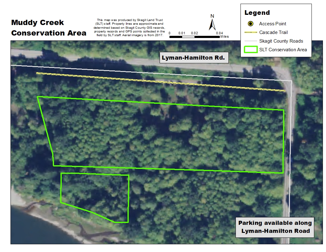
Click on the map above for an enlarged image. Map created using 2017 NAIP aerial imagery.
From Mount Vernon drive east on Hwy 20 and turn right (south) on Cabin Creek Rd. Take a left (east) on Lyman Hamilton Road. Muddy Creek Conservation Area is located to the south and west of the road, inside of the bend and between the road and the Skagit River. Park along the shoulder of the road and drop off road grade into the property. The Cascade Trail runs along the north boundary of the property.