This winter, we invite you to walk the trails on some of our other properties. We know you love to get out into nature. Quiet hikes outdoors can be very restorative. Here are five great spots to easily explore Skagit Land Trust’s conservation work:
Barr Creek Hegg-Benson Trail
This is a short, magical trail through old forest. 1.5 miles east of the turnoff for Rockport on Hwy 20, turn onto Conrad Road. Look for the Barr Creek Conservation Area sign. The Hegg-Benson Trail wends its way a little over half a mile through the Conservation Area and connects to the Old Sauk Mountain Trail. Only adventurous hikers will explore beyond our property boundaries, but those who stay in the Conservation Area are just as rewarded. Barr Creek tumbles alongside the north end of the trail and a bench overlooking a waterfall awaits those who wish to pause and rest. This property was protected with birds in mind. As the forest matures it will provide potential habitat for roosting eagles, nesting marbled murrelets and northern spotted owls. In the meantime, look for evidence of red-breasted sapsucker and pileated woodpecker. Adjacent to thousands of acres of federal lands and wilderness, you never know what other wildlife you will encounter while walking this quiet trail! (Tip: winter is a splendid time for this hike as the falls are impressive.) Click here to visit the property page.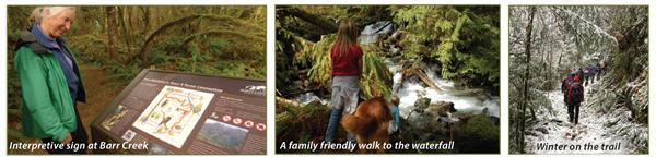
Utopia
About 7 miles east of Sedro-Woolley, ¼ mile east of the intersection of Utopia and Hoehn Rd, there is a gate with Skagit Land Trust signs. Park in front of the gate or on the road shoulder. Although there isn’t currently a developed trail through this 88-acre property, one of our kind neighbors keeps a path mowed to the Skagit River which is .6 miles from the gate. Follow the trail across Wiseman Creek and through several areas of restoration plantings. Look for evidence of wildlife that make their home here - beaver, elk, coyote. Small areas of mature conifers attract owls and spring wetlands provide great habitat for amphibians to lay their eggs. This is an ideal property for four season hiking. Look for eagles along the river in winter. Berries are abundant in spring and summer. Watch for migrating geese in the fall. Click here to visit the property page.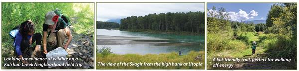
Little Mountain-South:
Most people access Mount Vernon’s Little Mountain Park via the northern summit parking lot. However, a nearly secret trail to the top starts at Skagit Land Trust’s Little Mountain Darvill Conservation Easement off Hickox Road on the southern side of Little Mountain. Although this is a private property, the landowner generously maintains a publicly accessible trail. Park in a 2-car parking area. Expect solitude until reaching the city park, just over ½ mile up the trail. Look for a variety of fungi and fungi associated plants at your feet and birds and other wildlife making use of the many snags left standing. (Tip: this is a great hike for kids as many things to explore). Click here to visit the property page.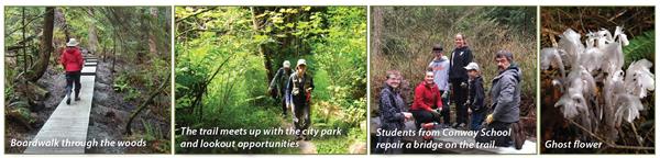
Guemes Mountain & Valley
After a ride on the Guemes Ferry from Anacortes (Tip: consider biking on), travel to a small parking area about a mile south of the intersection of South Shore Road and Edens Road. The Guemes Mountain Trail climbs from there, 550 feet over 1.2 miles to reach a beautiful, small meadow with views overlooking the San Juan Islands and towards Mount Baker. All year-round, hikers can walk up on a well-groomed trail through a mix of mature trees and shrubs. Spring is a popular time for wildflower viewing. Leashed dogs are welcome and Islanders are thoughtful enough to provide leashes and walking sticks for those who may have forgotten them. Click here to visit the property page.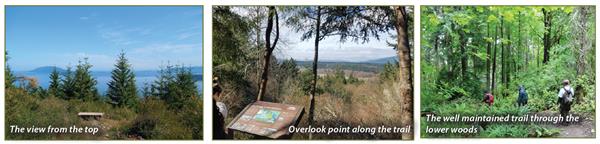
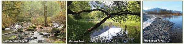
Cumberland Creek:
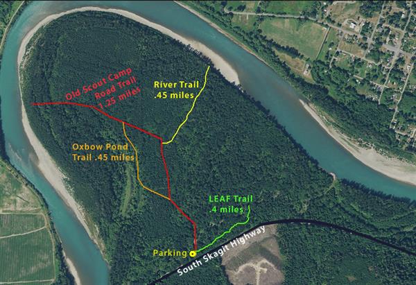
This area has a well-developed system of flat trails open year round that access the Skagit River. A small parking lot with Trust signs is on the north side of South Skagit Highway just past mile 12. The Old Scout Camp Road Trail leads to the cobbled shores of the River (Tip: print out the map on our website). Look for gnawed branches. This is evidence of beaver in the area. Eagles perch in the trees hanging over the beach. The River Trail meanders past massive moss draped big-leaf maple. Listen for early springtime calls of ruffed grouse. From the beach look across the River to our Muddy Creek Conservation Area. Connectivity of Land Trust properties allows wildlife, such as elk, to move safely across the valley. At the old oxbow pond, elk have been spotted on the far shore as well as wood ducks floating on the calm water. The LEAF Trail has several overlooks of Cumberland Creek as it winds its way past an unusual line of western red-cedar. (Tip: In winter, wear boots for a few muddy spots.) Click here to visit the property page.